These rains could lead to mudflows in areas burned by wildfires earlier in the year. A mandatory evacuation has already been issued for residents in the Holy Fire burn area.
A rough week in store
- Up to 6 inches of rain are likely to fall on the coast and valleys and one or more feet of snow will pile up in the mountains.
- A foot of snow is expected in the Southern California mountains with several feet in the Sierras.
- Flash flooding will become a concern, especially in urban areas.
- There is a threat of mudslides and mudflows, especially in and downhill from burn scar areas in all parts of California.
- Winds could gust over 40 mph across the valleys and could reach over 60 mph in the mountains.
- Significant travel delays at major airports and on the roadways are likely throughout the week.
- The strongest of the storms will be Wednesday and Thursday.
Light impacts started
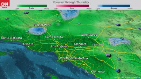
The first round of rain is impacting Southern California Monday.
Flash flood watches are in place for parts of Orange, San Bernardino, Riverside and San Diego counties with more than an inch of rain expected Monday. Even higher amounts are expected on the south-facing mountain slopes.
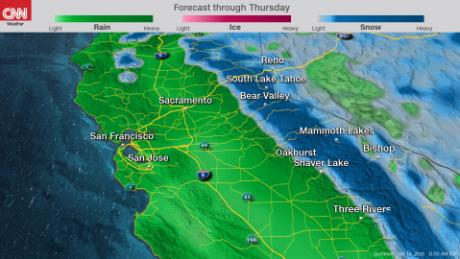
On Monday afternoon, light rain should begin to affect the Bay Area and linger overnight. The coastal ranges across Central California could pick up to an inch and a half with this first storm.
Light precipitation will move through Northern California overnight Monday into Tuesday.
The brunt of the storm is Wednesday
The second and third rounds of heavy rain will begin late Tuesday and last through Thursday.
The National Weather Service in Los Angeles is expecting a steady rain with heavier downpours during this period.
An additional few inches of rain could fall across the region.
During this time frame the Sierras will get the most snow, with the heavier snow piling up on Wednesday and moderate snow continuing to fall on Thursday.
The strongest winds across the state will peak on Wednesday and begin to decrease Thursday.
The region will begin to dry out again on Friday. The storm system then moves east into the Central and Eastern United States over the weekend.
No comments:
Post a Comment